Pacific Rim · Real USGS data
See the Ring of Fire as it moves
Live earthquake maps from the USGS, a Holocene volcano catalog from the Smithsonian GVP, and a one-year snapshot of global seismicity — with an auditable Pacific Rim corridor definition.
Initializing map…
Yearly snapshot
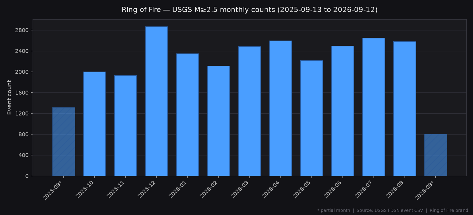
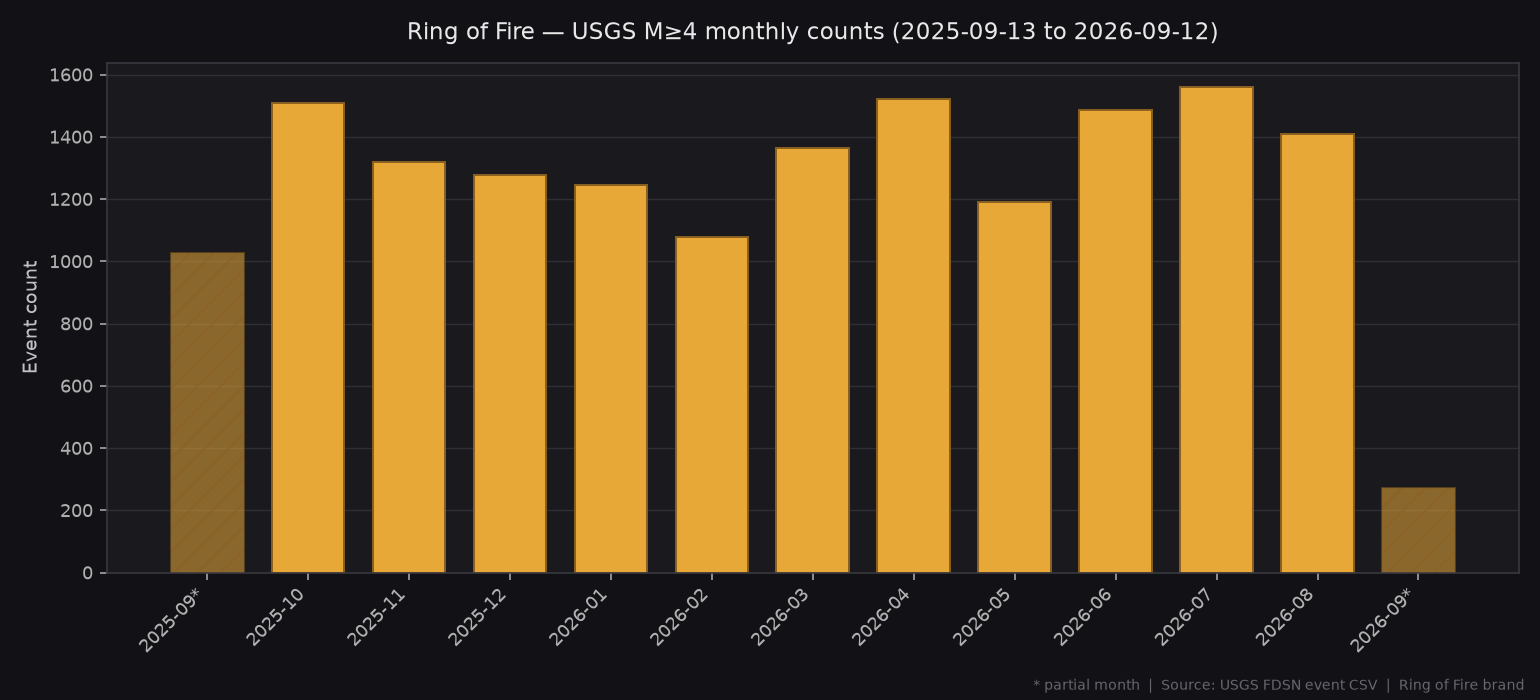
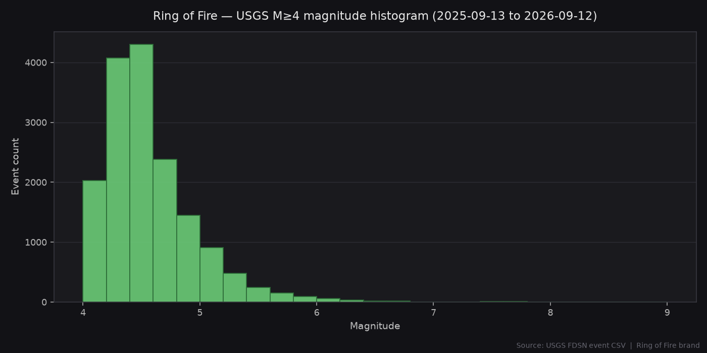
USGS FDSN catalog · 2025-09-13 → 2026-09-12 UTC · from SUMMARY.json
28,374
M≥2.5
16,268
M≥4
17
M≥7+
M7.8
Strongest
80.6%
RoF share of M≥4
13,117
RoF M≥4
Strongest in window: M7.8 — 64 km NNW of Ende, Indonesia (2026-08-14 21:58:21 UTC). RoF share = 13,117 / 16,268 M≥4 events inside documented corridor rectangles.
Last significant quakes
Full alerts digest →Catalog charts
From on-disk USGS CSV summary